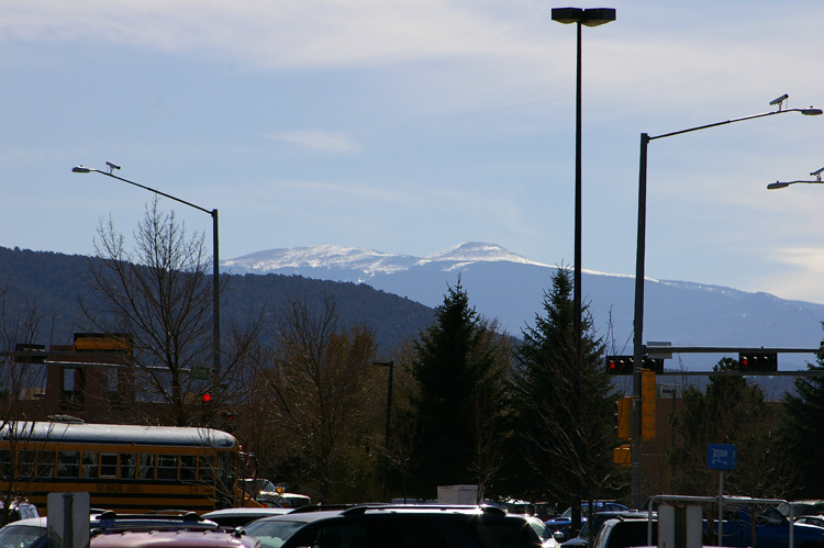
Well, that CAN’T be US Hill. Jicarita Pk is at (true) 177° from the Walmart parking lot and US HIll is at 182°, or 5° to the RIGHT. Using Google Earth, it’s pretty easy to find the formation just to the north and slightly east of Jicarita, but it doesn’t give it a name. And I can’t find my map of Carson Nat’l forest, which might name it.
I give up…. Neither the USFS map of Carson NF nor the USGS topo map or even the authoritative AAA “Map of Indian Country” give that feature on the left a name. That doesn’t mean it doesn’t have one… just not one that’s officially recognized. After all, according to the USGS, we can’t see Lobo Peak from here. It’s on the north side of the mountain and we see is calld Perra Peak!
J
Comments on this entry are closed.
View 3,000 Photos Back to 12-15-2001!
• FotoFeed features almost 3,000 images, and you can view almost ALL of them sequentially, backwards or forwards . The current WordPress site goes back to June 14, 2009. On that page is a link to the last page of the preceding site, which goes all the way back to December 15, 2001.
• To see all photos starting from the present, just hit the "Previous Entries" or "Previous Post" links and work your way back.
• Unfortunately, you can't go forward from the oldest page (12-1-2001). But you can go from forward starting from January 5, 2006. From the preceding page, however, you can only go backwards to the beginning. Confusing, I know.
• The Photos by Category, Archives, and Search FotoFeed menus [right] only apply to the current site, going back to June 14, 2009, but you can find all kinds of interesting things.
• You can also use the Sitemap pages to search for photos at the current site by category and titles in a list format. Try it!
isn’t the one on the right Truchas?
No… 🙂 I’ll post the answer shortly!
US HIll and Jicarita?
One of them is Jicarita. And I’m sure as hell not arguing with YOU, Mr. Plot-Out-the-Elevations-on-a-Fancy-Website! 🙂
Did not, did not, did not…. ;P
Jicarita I KNOW, and I’m guessing on US Hill… that’s just sort of where it OUGHT to be, given the number of times I’ve driven around it.
J
But now that you mention it… 😉
Well, that CAN’T be US Hill. Jicarita Pk is at (true) 177° from the Walmart parking lot and US HIll is at 182°, or 5° to the RIGHT. Using Google Earth, it’s pretty easy to find the formation just to the north and slightly east of Jicarita, but it doesn’t give it a name. And I can’t find my map of Carson Nat’l forest, which might name it.
I give up…. Neither the USFS map of Carson NF nor the USGS topo map or even the authoritative AAA “Map of Indian Country” give that feature on the left a name. That doesn’t mean it doesn’t have one… just not one that’s officially recognized. After all, according to the USGS, we can’t see Lobo Peak from here. It’s on the north side of the mountain and we see is calld Perra Peak!
J
Comments on this entry are closed.